Langkawi is a beautiful archipelago of 104 islands nestled in the Northwest coast of Malaysia, bordering Thailand. Since we had two weeks to kill before starting work at a hostel in Penang, we decided to travel over to Langkawi to see what it had to offer.
We stayed on the biggest island of Langkawi near the famous beach of Pantai Cenang. Although most of our time in Langkawi was spent on this beach along with eating Roti Canai, we decided to devote a few days to do some hiking. Especially since the owner of the café we so often frequented told us that we were in danger of tipping the plane over to one side when we flew back home (and he didn’t sound like he was joking)!
Overview of hiking trails in Langkawi
We had our sights set on two of Langkawi’s highest peaks: Gunung Raya, at 881 masl and Gunung Machinchang (also spelled Mat Cin Cang), at 850 masl. However, information on hiking these two mountains is muddled and unclear when searching on the internet (and even when asking locals on the island of Langkawi). Most will advise you, for any hiking trails, to hire a guide. Although I agree that hiring a guide may be useful if you are mainly interested in learning about the flora and fauna of the jungle, I found that for the hiking trails themselves a guide is not so necessary, provided you have some experience hiking and have a reasonable level of fitness.
Some of the highlights of hiking in Langkawi include:
- Trying to spot the Great Hornbill in the treetops;
- Looking out for wild monkeys;
- Trekking through lush jungle and discovering crazy looking insects!
And some advice before you set off:
- The humidity in Langkawi is very high, so be prepared to sweat a lot more than you’re used to;
- Bring lots of water;
- Use mosquito repellent.
What follows are some guidelines for hiking to the summit of Gunung Raya and Gunung Machinchang.
Gunung Raya
The summit of Gunung Raya can be reached by either driving up a paved road, or by climbing up 4,287 stairs. We opted for the latter.
To get to the trailhead, we walked about five minutes or so along a paved pathway following a river that appeared to be a popular swimming hole with the locals. We then arrived at a blue sign at the base of the stairs detailing the number of steps and elevation.

The steps started out at a slight incline, but quickly became much steeper. Also, one thing to keep in mind when hiking in Langkawi is that the weather here is very humid. We were soon dripping in sweat as we made our way up the steps.


As we approached the end of the stairs, I breathed a sigh of relief. Unfortunately, I soon realized that the end of the stairs is not the actual end of the trail, as we still had to make our way up a paved road to reach the lookout point of Gunung Raya.


Gunung Raya: The Numbers
- Elevation gain: ~840 m
- Total distance (return): 8 km
- Duration: Between 3 to 4 hours, depending on fitness level and how long you spend at the top.

Gunung Machinchang
Gunung Machinchang is better known among tourists due to the steepest cable car in the world that you can ride to reach the summit.
There is very limited information available on the internet about the hike up to Gunung Machinchang. Fortunately, the trail is relatively well marked and Open Street Maps (and maps.me) includes the main portion of the trail. (Note: If you don’t know what Open Street Maps or maps.me is, click here). The trail shown on Open Street Maps ends once you reach the ropes that are needed to climb up the mountain. At this point, however, you simply follow the ropes the rest of the way up so that there is little chance of getting lost from this point onwards.

Here’s some useful information about Gunung Machinchang:
- Gunung Machinchang is actually a series of peaks along a ridge, rather than one peak in particular. Although the cable car leads you up to the summit of Gunung Machinchang, this peak was not the same as the one we summited, although there was a signpost at the top saying ‘Gunung Machinchang, elevation 701 m’.
- Apparently, there is also a trail (known as Sky Trail) starting from the Seven Wells Falls that will take you up to the top station of the cable car, although I’m not sure how it compares to the trail we took.
- The trail head can be found at the Seven Wells pools above the waterfall. The stream that feeds the pools runs parallel to the trail, and you will see a sign at the start of the trail.


Gunung Machinchang: The Numbers
- Elevation gain: ~680 m
- Total distance (return): 8.5 km
- Duration: Between 3 to 5 hours, depending on fitness level and how long you spend at the top and in the Seven Wells pools!

So, which mountain has the better hiking?
If you only have one day for hiking and need to decide between the two, then I would definitely choose Gunung Machinchang over Gunung Raya. Here are my reasons why:
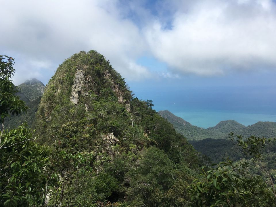
- The views at the top of Gunung Machinchang are amazing. You can see the cable car off on the adjacent peak of Machinchang, as well as the archipelago of islands that make up Langkawi.
- Undisturbed hiking. Even at the summit of Gunung Machinchang, we saw no one! (At Gunung Raya, I should also mention that we saw no one on the trail, but at the summit expect to find many tourists as there is a road to the top of the mountain)
- The Seven Wells pools at Gunung Machinchang are so nice to cool down in after coming back from the top! They’re also a beautiful sight to see by themselves.
- With Gunung Raya, you’re simply walking up a never ending staircase (great training, but a bit dull and also hard on the knees coming down). With Gunung Machinchang you have trails, bridges and ropes, making it much more interesting and challenging.
Both trails give you a good chance to see wildlife, including the Great Hornbill. Although we didn’t actually see this amazing bird on either of the trails (because the jungle was so dense and it was way up high in the trees), we did get a chance to hear it. It produced a distinct raspy sound similar to what you hear in the video below. Also, when it took off to fly, we heard a great “whooshing” sound as it spread it’s wings.
If you have any questions about either of these hikes, leave your question in the comments below and I’ll do my best to help you out!
You might also like:
- Complete Guide to Trekking in the Cameron Highlands
- Hiking to the Summit of Mount Agung, Bali’s Highest Volcano
